 |
| Foulk Road- still in Waterloo here- This field had emergent plantings. |
The last weekend in April. Used to be I was too busy to ride bicycles on this weekend, but now I have "time off" so I try to take advantage of my situation these days! Saturday it was supposed to be cloudy, but free of precipitation, so I went out "fore noon" and got onboard the Salsa Cycles Stormchaser single speed.
The plan originally was to go North, as that was where the winds were supposedly going to be blowing from, but when I got out I changed that up as the winds seemed to be more Northeasterly. Makes sense. It is the last weekend in April, after all...... (Past Trans Iowa riders will understand this)
It also seemed to be that the Sun was trying to shine, and that a cloudy day was not going to be happening. It was warmer too, so I rode without a coat for the first time in a long time. Just arm warmers this time, otherwise it was standard dress for Summer. I was a tiny bit chilled later when going into the wind, but otherwise the garb was perfect.
The way I ended up heading out of town was a way that N.Y. Roll seems to prefer when going Southeast of town. I went out on our excellent bike path system to Evansdale, then on to the CVNT, but just a short distance to Foulk Road. I decided to see how far South I could get on that and if I could make it out of the county, I'd loop back toward town on some other roads. I never look at maps much for these rides, by the way. I usually just ride by the seat of my pants for navigation. It's much more fun, and it makes you look at things, think things through, and learn. Unlike following a prompt for someone else's GPS track.
Blah! That sounds dreadfully boring to do it that way to me, but to each their own.....
 |
| I didn't see any farming actually happening, but signs that it was were everywhere I went. |
 |
| Foulk Road is pretty much flat for miles South of Waterloo, but eventually it does get hilly. |
|
The roads were decent going South on Foulk. No fresh gravel here, but the roads weren't devoid of chunk by any stretch of the imagination. Pretty "normal" conditions, actually. The skies were hazy, the light was odd to begin with. Almost dreamy. The wind was a mere breeze, but of course, it was mostly at my backside going South, so take that with a grain of salt!
Foulk Road is pretty flat until you get closer to Benton County. Then the rollers kick in. Nothing unusual here, just typical Iowa countryside. The gear on the Stormchaser wasn't too stiff for me to stay seated and climb everything I ran across here.
 |
| Barns For Jason #1 |
Once I got into a section of Foulk Road I'd never been on, I ran across several 'new-to-me' barns. So, this post will be a bit heavy on the 'Barns For Jason' content!
 |
| Another idle planting rig. |
 |
| Barns For Jason #2 |
 |
| Barns For Jason #3 |
|
This section of Foulk Road has a LOT of smaller barns on it. It seemed for a while that I never had my camera put away. It also happened that by this point into the ride that the hills kicked in. So I was juggling speed, braking, a camera in one hand, and taking shots as I rolled by. Sometimes I was shooting completely blind backward over my shoulder. Other than a bit of leveling and cropping afterward, which I usually have to do anyway, they were perfect shots. Crazy!
 |
| Barns For Jason #4 |
 |
| Barns For Jason #5 |
Now, I have to admit that as I was going South I was sure that I was going to roll into Tama County at some point. I forgot that Benton County shares part of Southeastern Black Hawk's border. So, when I saw an offset in the road, I guessed rightly that I was going into another county, I just didn't know it was Benton County until I saw that I was on 11th Street. Tama County uses alphabet letters for their North/South gravel roads. So, here I was, in Benton County. Now to find my way out and loop back to Black Hawk County.
 |
| A blind shot I took looking back at Black Hawk County. The border is in the middle of the offset corner there. |
 |
| Headed West now in Benton County. That's Hickory Hills on the horizon to the left of the gravel. |
I found a Westward road after going South a mile into Benton County, but it dumped me out on a county blacktop and I had to go either right or left. I was not sure, so I busted out my iPhone, (I know.......
cheating!) , I took a gander, and saw that I was a half a mile from a gravel road that would have been a difficult acquisition in my quest to ride every Black Hawk County gravel road by the end of the year. It is a one mile section of road right on the Southern county line. This is rare in Black Hawk County, as there are only maybe 2 1/4 miles of Southern gravel border roads, and really, that's it for any type of road. Why Black Hawk County has no Southern border roads is a mystery to me, but there aren't many, obviously, and now I had a perfect opportunity to bag about half of what there is. I was going for it!
 |
| Barns For Jason #6 - Just off Paydon Road in Tama County. |
The road's name is Paydon Road, and it leads up to a "T" intersection at the corner of Hess Road (Black Hawk County) or X Avenue (Tama County). It also leads to what might be the highest point in the county on Hess Road just a little way North of that intersection. I stopped there and took a break, ate some food, and just soaked in the day.
 |
| From the highest point on my ride Saturday looking North up Hess Road. |
Time to head back toward Waterloo, and into the wind. It wasn't bad, really. At least in the hours just after noon it wasn't. The roads weren't any different, really. Graveled, but not real bad. Climbing the rollers wasn't a big deal.
 |
| Barns For Jason #7 |
 |
| Hero gravel on Quarry Road |
I was not expecting to have a lot of exciting times after I got back on Quarry Road and much more familiar territory. But as I approached Hammond Avenue, I described what appeared to be a cyclist coming down the hill I was approaching. It turned out to be a local mile-muncher, whose name is Tom and has like three Fargos, and a couple are single speeds. We stopped and chatted for a bit, then parted ways. Not long afterward, I was overtaken by a car. It slowed enough that the passenger was able to say, "
Nice day for a ride!" It turned out to be Trans Iowa veteran and volunteer, Mike Johnson. I was flabbergasted!
 |
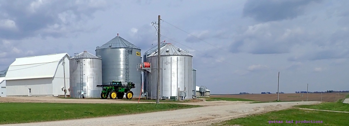
| Huge farm machine. Even huger bins! |
So, with that surprise I was smiling ear to ear. I hit the rest of Quarry Westward and ran into some deep, really chunky gravel. It was not bad, but at the end of a ride, not ideal. Then I turned on Aker and wow! Heaven! Super hero gravel, fast, smooth, and fun. Only the last mile of Aker was covered in chunk. But by that point, I didn't care. It was an excellent ride.
I was thinking I'd return on the Sergeant Road bike trail, but it was such a nice day that all the odd cyclists were out and getting around them was a chore, so I peeled off at Martin Road, made my way over to some alleys, and wandered home somehow. Totaled out at about 3.45 hours for the ride. No idea on mileage. Anyway.... Good times. Chance meetings, clear skies, and light winds. I couldn't have asked for a better day out.


5 comments:
Sounds like a great day!
Did you use any of those roads for past Trans Iowas?
It was great running into you this weekend, Mark!
I managed to hit up the level b's over on 110th street and was reminiscing about the GTDRI '18 and how I wouldn't have a clue any of those roads existed hadn't I participated that year. Thanks for showing me some of the sickest MMRs Iowa has to offer!
I enjoyed reading about your riding to where the counties join, Mark. It brought back, to me, memories of some rides I did some years ago when I purposed to ride to the county lines of the counties that touched our rural southwest Missouri county (Cedar). My intention was to do as much as possible of each ride on gravel roads. With Cedar County Map in hand, I embarked on my adventures. Sometimes it was a guess if my map was correct. Some roads on the map did not really cut through or exist.Let's say backtrack. I just had to look at the road numbers I had already been on to orient myself and location to know if I had reached those county lines. Often, in Missouri, most county lines are marked by a small road sign. Not always, though,especially on gravel roads; only on black top roads. Those trips taught me a lot about preparation and following my map. The last one was most memorable when I ran out of water and filled my bottle from a strangers yard hydrant. It's a good thing I did because it was pretty warm that day and dehydration was setting in. One of the gravel "roads" was a rock B road which I thought was more a jeep trail. Funny thing was a jeep came along on that road as I was riding. He was moving slowly and looked as surprised as me when he saw me. Although it would be inappropriate for me to attempt to draw a comparison, it's adventures like these which lead me to appreciate what T.I. riders must have contended with to participate in that event. My apology for the wordy comment, Mark.
@DT - Trans Iowa only came around Waterloo twice- v3 and v12. I did not ride on any of those roads Saturday, but I do often.
@Tomcat- Thank you for coming along and finding out what fun those Level B's are. It was really fun to see you and chat on Saturday as well. I think N.Y. Roll was a bit jealous.
@graveldoc - Those are the best adventures, aren't they? No need for an apology for a great story/memory. I enjoyed reading about it. Thank you!
Soul s like a fun day and great weather!
I have lately been doing the opposite, and building a route in my GPS device. If I don’t do that, I can never remember what route I came up with on the map at home. Maybe where you ride, most roads are gravel, but around here, only some of them are, and al though we have a basic grid system, the majority of (gravel) roads don’t connect through endlessly, So when I used to just go out and ride randomly, I ended up missing a lot of the smaller, more fun gravel roads, because there is often only one way to get on them and link them up into a ride.
Post a Comment