 |
| Let's try this again. |
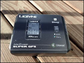
I decided to go with the Super GPS unit since the one I really wanted has its introduction date pushed back again and again. Anyway, this is the top dog for the Lezyne lineup and it comes with all the bells and whistles. Not that I need them, but it only cost a few bucks more and the loaded "Option 1" kit gave me a second mount, which should come in handy.
Anyway, I will be reviewing the thing. How it is to set up, use, and how it performs. Of course, you can connect it to your phone, import routes, make bread crumb tracks of your ride, get elevation, blah, blah, blah. It comes with a speed and cadence sensor along with a chest strap to monitor your heart rate. It also is Blue Tooth and ANT+ compatible, so you can power meter, Di2, and Lord knows what else. Most of that nonsense will be lost on me.
 |
| A tackle box with a lot of lures. I'll only use a few of 'em. |
Cadence? pfft! Heart rate? Got that on my fitness watch already. Strava? Really..... No. Routes to download and follow turn by turn? Not necessary. I can read signs. I'm not afraid of getting lost.
I would have enjoyed this device on the recent Fargo Reunion Ride. I could have checked the track, the elevation gain, and saved the route for another day. In the instance of being at an event, those metrics would be enjoyable to see. I can certainly live without that, but I could see getting into that part of this device.
Trans Iowa Recons? Definitely! Laying out any event course, like the Geezer Rides, or whatever, would be a nice way to make use of this device for me. Elevation gain info, gradient info, and turn to turn mileages. that's helpful to me in some ways. ANT+ and Blue Tooth connectivity will help my wife keep track of me. that's good for her. No more "1980's rides" unless I leave the Super GPS at home!
Note- The Lezyne Super GPS was bought with my own damn money and I am writing this stuff up about it because I want to. Not because it benefits me in any way whatsoever.

I have enjoyed looking at minimum maintenance road maps and plotting a course for the Garmin for a ride. I have found some really cool routes that way. Enjoy!
ReplyDelete