 |
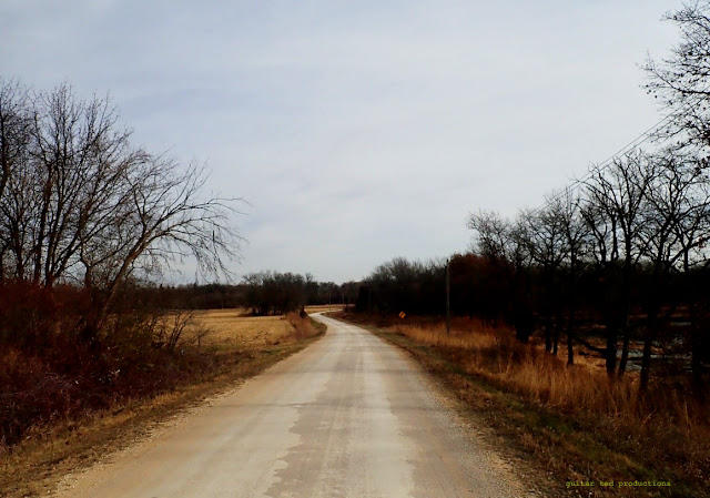
Escape Route- Janesville, Iowa
|
Well,
that was a big ride in terms of "
The Quest". The gravel roads I haven't ridden in Black Hawk County are now very few and far between. Especially now since I knocked out a big chunk in the Northwest corner of the county. This is the area that is broken up by the '
Turkey Foot' as the Native Americans called it.
The 'turkey foot' is the confluence of the West Fork of the Cedar River, the Shell Rock River, and the Cedar River, (formerly known as the Red Cedar River at first). These three rivers form a shape where they come together which the Native Americans found looked like a turkey's foot. This area also was home to the "Big Wood", an area of hardwood trees which somehow escaped the ravages of prairie fires to form a huge tract of forest, (for Iowa), stretching from Eastern Butler County all the way across to where Denver Iowa is now and from just South of where Waverly Iowa is now to the very Northern tier of Black Hawk County, then down along the Cedar River to Waterloo, Ia, where there was a break in the trees and the prairie came right down to the river banks. This is why Waterloo, Iowa was first known as Prairie Rapids Crossing.
Native Americans from the surrounding areas would Summer in the Big Wood, hunting, fishing, and gathering for their Winter stores. Once Fall came they all would head back to their tribes. I often think about that when I ride through this area, which still has a sizeable remnant of the Big Wood. Now days the Turkey Foot is called Turkey Foot Heights and is a gated community of well to do Iowans. The hills which feature remnants of the Big Wood West of Denver is called 'The Denver Hills' and features pretty fancy-pants homes as well. This stretches over almost all the way to Waverly. Ingawanis Woodland, the tract of hills and woods I ride mountain bikes in, is also a part of this area.
I decided to make the village of Janesville, Iowa my embarking point. It is a curious little town which straddles the border of Black Hawk and Bremer Counties. In fact, it lays claim to being the oldest city in both counties. I parked the truck in a City Park along the Cedar River, and then headed across an old steel gabled bridge which used to carry traffic for Highway 218 across the Cedar, but now is a county blacktop. This I took West out of town and onward to knock out my first bits of gravel in this area.
 |
Marquise Road is truncated here at the Shell Rock River coming from the East.
|
 |
Headed back East on Marquise Road. There isn't much gravel, but I had to get it ridden!
|
Marquise Road was up first. This road forms the border with Bremer County to the North. From Janesville it starts out as a black top, then the County road goes South, but Marquise continues on a a chip seal road until for the last half mile, which is gravel. Then it is cut off by the Shell Rock River. That meant this stretch was an out-and-back. The rivers would cause me all sorts of running around on this day!
 |
The Southern end of Taylor Road just turns right into someone's driveway!
|
 |
Newell Road looking North.
|
There were a couple of out-and-backs up next interspersed with long stretches of county highway. First was Taylor Road, an offshoot to the South. In typical Black Hawk County fashion, it ends by just turning right into someone's driveway! I just think this county is so odd in how they minimally sign things like this.
Then it was back, with the wind, to the North and back West on a county highway to get across the Shell Rock River. The wind, by the way, was blasting out of the Southwest at around 25mph. Fun times! Anyway, once I got across the Shell Rock and had ridden two miles or so of pavement, I found my next offshoot to the North called Newell Road.
This was approximately a 3/4's mile out-and-back, so 1.5 miles total, and this road was truncated by the West Fork of the Cedar River. Back to pavement again! I found myself soon enough in the little hamlet of Finchford, Iowa.
 |
| A church in Finchford, Iowa |
|
 |
Marquise Road West of the Shell Rock and North of the West Fork of the Cedar River.
|
Leaving Finchford North on more pavement, I rode a mile to get to the Western bit of Marquise Road I had to bag. This would be 2.5 miles in and then back out again. This road has memories for me, actually. I had been on it before, but not on a bicycle. This was a road that almost was in Trans Iowa v3.
I was doing recon for the third Trans Iowa, by myself in those days, in my old Honda Civic hatchback. I had been planning on using Marquise Road as a way to take the riders from the Northwest area of Janesville into Janesville itself, because they had a convenience store there, and still do. Every map I could find showed a bridge over the Shell Rock on Marquise Road, so I felt confident I could route the event over this road.
And it is a cool stretch of road with curves and woods. But, as you know, that bridge has been gone a long, long time. Ironically, the 'up-to-date' DOT maps still show this road going through! Ha! Well, it caused me a five mile round trip just to bag this Western section of this road. And then I went onward....
 |
The gate near the old ending of Marquise Road. You used to be able to go further by about 200 yards.
|
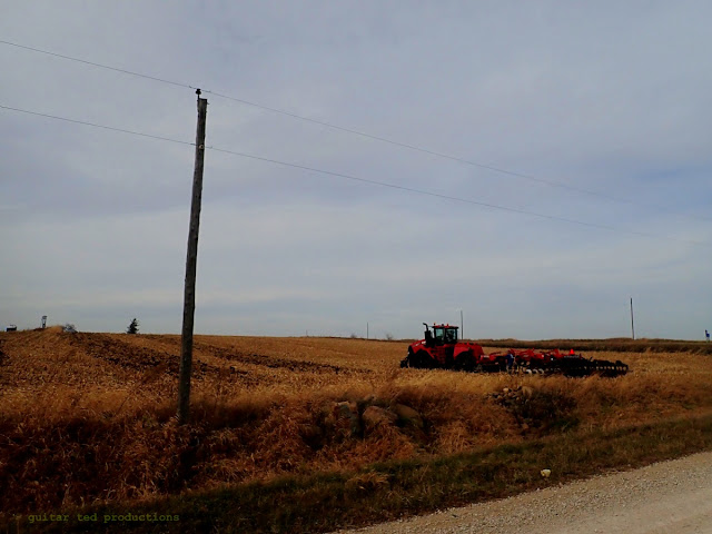 |
A big rig tilling the fields for next season.
|
Then I made a mistake! Up until this point I had been running off memory, since I had stared at the maps so much, I knew the route by heart up to a point. Well, my memory failed me as I came back West on Marquise Road. Where it turned to pavement for its final half mile in Black Hawk County, I turned back South and went back to the West Fork Road, which was just North of Finchford. I thought it was my next mission, but it wasn't.
No harm- no foul though, I just had to make the West Fork Road and Butler Road an out-and-back instead of a single pass is all. Once I did this, I was back on track again. This bit took me to the very Northwestern corner of the county, which is sort of unusual. This and the southwest corners are the only two corners you can reach via gravel roads.
 |
This is the very Northwestern corner of Black Hawk County.
|
 |
Butler Road looking South
|
After rectifying that miscue, I went back South through Finchford again on county highway to reach the corner with Cedar Wapsi Road, which is paved going East, but there is a short section going West that isn't paved. This then turns South and becomes Butler Road, which is the border road with Butler County.
This took me to Mark Road and my last section to bag up here. From Mark Road East I took in Pashby Road and Van Wert Road, both going one Mile to the North off Mark Road to C-57/Cedar Wapsi Road, and then taking Mark road to its end at Union Road, which is paved.
 |
A sign seen off Pashby Road looking North.
|
 |
Gerholdt Cemetery off Van Wert Road near the intersection with Mark Road.
|
From there I took Union to Cedar Wapsi Road and then I did a couple bits of short gravel and another section of Waverly Road pavement sandwiched in there to get back to the truck. It was a great ride, but I was out for three hours to bag about 11 miles of gravel. Such was the problem with getting all these disjointed sections of gravel in and with having to traverse across all these rivers. I ended up crossing all three branches of the 'turkey foot' at one point or another too. So, I was scrambling all over this corner of the county. But I got everything mopped up that I needed to, and that's the good news.
So, this leaves me with just a tiny bit left now to go. I'm looking forward to getting this knocked out. Stay tuned.......


