 |
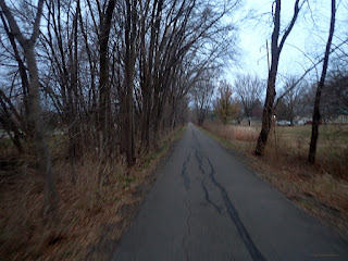
Escape Route: Sergeant Road Bike Trail
|
This post could also be called "
The BH,G,B and B Ride", or the "
Four County Tour", and it could also be called "
The Horse And Barn Route". But since this is part of the Virtual Turkey Burn thing I proposed, I'm going with the "Turkey Burn" theme on this one. But those other names should give you a clue as to how the route was for visuals.
But before I get to any of that, I have to lay the foundation for this year's Turkey Burn. The idea of this goes back into the 00's when we would gather together and ride at what was then Camp Ingawanis (North side, natch), and we'd ride around the trails and then have some chili at the end of it all. This idea carried onward for several years until at some point in the teens it kind of died out. No one locally was picking the idea up. So, I just decided to start doing my own here a few years ago.
This year I had options and then......I didn't, and I had to go Saturday or it wouldn't have worked out. The Saturday after Thanksgiving was always the traditional date for this anyway, so that was nice. Then the weather.... At first it looked 'okay', then it was saying we'd have a spot of rain, then at the last minute, the forecast looked spectacular. Well, as good as you can hope for in late November, at any rate. Temperatures were supposedly going over 50°F by noon. Then there was wind. Of course, there always is wind. I had a route planned out, but when I saw the final wind forecast on Friday I quickly amended my route plan, came up with an entirely different plan, and set off to go get a good night's sleep.
I also had a time limitation on the ride. I had to be back by 2:00pm. So, no full-length century. I could squeeze in a metric though, and with the Sun coming up around 7:00am, I could squeak out that distance with time to spare if nothing went wrong.
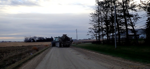 |
I had to dodge this liquefied poop spreader machine on Ranchero Road.
|
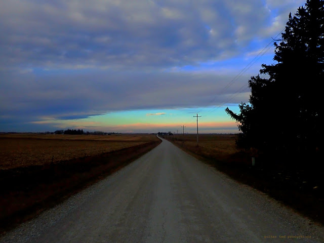 |
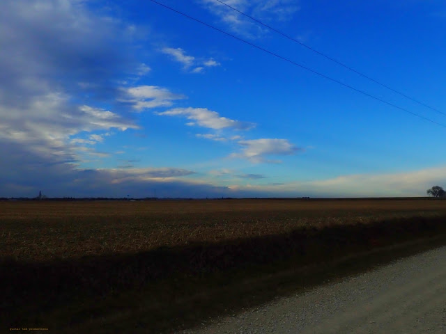
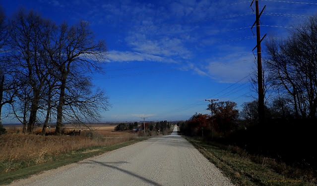
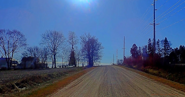
Looking off into Grundy County headed West on Ranchero/170th
|
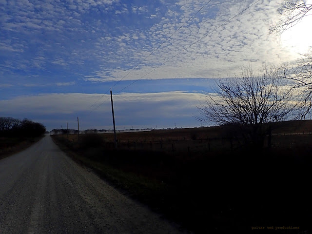
It was chilly to start. Low 30's, but the winds were light and out of the Southeast. The flags were barely moving on the houses I passed by on Ranchero Road. My plan was to head over toward Dike, Iowa, head North a bit, more West, then a big push North through Grundy County and into Butler County. The wind was to switch around to the West and then Northwest and get really brutal by around 11:00am. they were talking 22mph with gusts to 35mph. My hope was to cover most of my North and West bits before the wind got up and was tough to ride against. The back half of the route would be tailwind city.
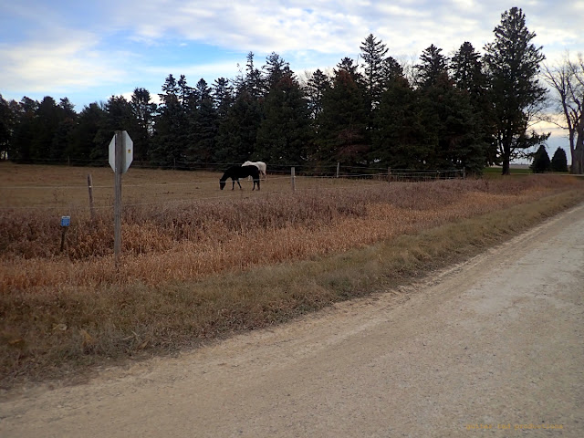 |
Horses. I saw LOTS of horses on this route.
|
 |
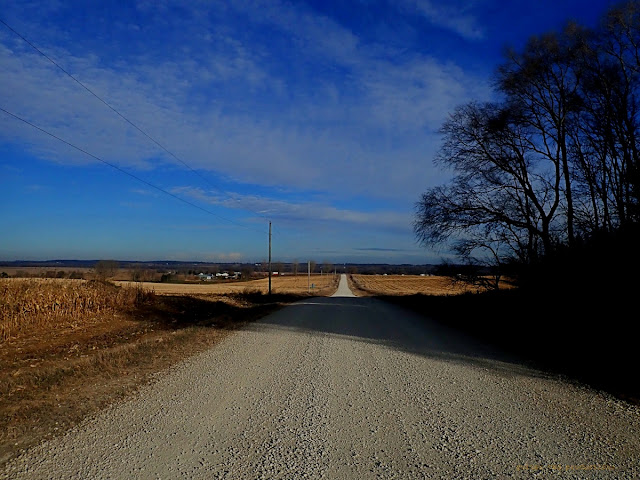
That is Dike, Iowa off in the distance as seen from 150th in Grundy County
|
By the time I had gotten up Vista, over a bit on the black top, and up Vale to 150th, there was some wind happening, but it was light. I kept on the gas riding my Twin Six Standard Rando v2 single speed and pushed Westward to "S" Avenue where I turned North for a bit of a longer run.
 |
| The clouds gave way to Sun for a bit as I rode North on S Ave. |
|
 |
Looking down at the Beaver Creek Valley riding North on S Avenue.
|
 |
Crossing Beaver Creek on Terrace Avenue
|
Eventually I turned East on Westbrook Road and the another push North on Terrace Avenue which is in Butler County. By now the Sun had set the temperatures off up through the 40's and as I labored up the steep, long-ish climb after crossing Beaver Creek, I was considering taking a clothing change stop. But not just yet. I had packed my Twin Six vest and a lighter pair of gloves against what I was expecting for temperatures later into the ride.
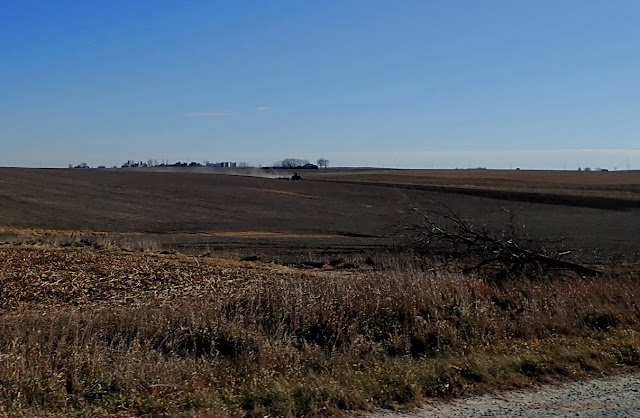
I don't ride much in Grundy or Butler Counties, but I think after this ride I may make a change in that. The terrain was flat in places, but nearing the Grundy-Butler line things get a lot more interesting. Hills kick in and in Butler County you have a lot more streams which have deeper valleys, making for more climbing and more interesting landscapes.
 |
The big climb on Terrace Avenue dead ahead.
|
 |
And the other side.
|
My biggest climb was tough, but I didn't have to walk it, which was good! Then onward to 310th, over to Willow, up North a bit more across the West Fork, and then onward to the last of what could be headwind trouble.
 |
A big truck kicks up a dust trail behind it. I'm riding East on 310th here.
|
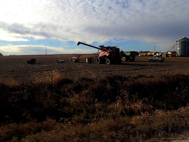 |
A few farmers were on the other side of this equipment here getting it ready to store for the Winter.
|
By this time I was running across traffic out on the roads. It was really dusty out there and I had issues with gravel dust inhalation during and after the ride. I should have pulled out one of the buff thingies I was packing but I was too busy trying to get all the North stuff done before the wind got up.
My goal was to reach Janesville, at about mile 45 on the loop, before noon. I was doing well on that front, but I kept pushing on. By the time I had 30 miles in I still had not stopped at all. My first stop would be to swap out clothing as I was getting hot and I was feeling it as I went up Willow Avenue toward the West Fork crossing.
 |
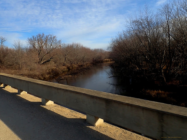
This is the only bridge in the area that crosses the West Fork via gravel.
|
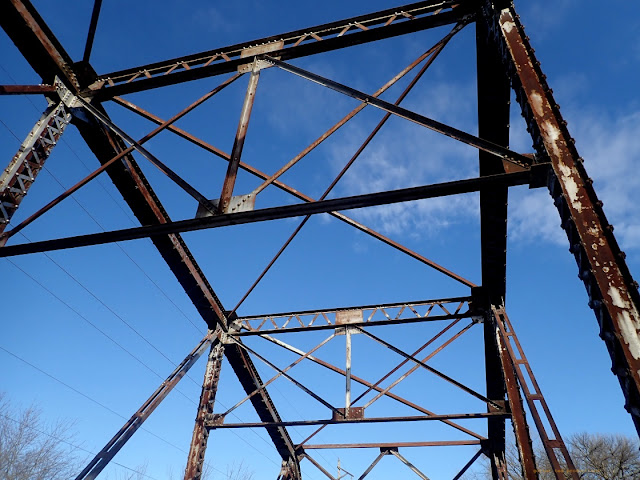 |
It's crazy that this iron has lasted for decades. How much longer can this bridge survive?
|
I decided to stop and swap out clothing at the bridge over the West Fork (of the Cedar River). This is one of the three rivers that forms the "Turkey Foot" confluence area of three rivers including the Shell Rock and the Cedar. The indigenous peoples that used to come to this area to hunt in Summer would convene at the Turkey Foot for councils and other gatherings.
Now most of the Big Wood that covered this area has been cleared for agriculture. It was an odd area for Iowa. Most of the surrounding area was open prairies. As I rode through on Saturday I couldn't help but think about how maybe that old growth hardwood forest should have been preserved. But, too late now.....
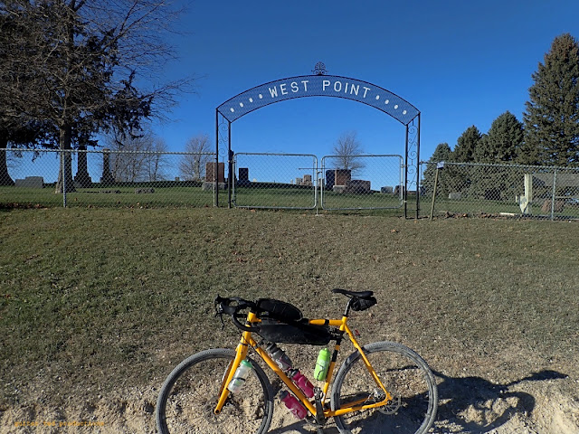 |
Old West Point Cemetery near Waverly Junction
|
 |
| Headed toward Janesville here on 265th. |
|
From the West Fork it is hilly.
East on 290th, North on Butler Road, then back East on 265th. By the time I crossed County Road C55 and went up the big hill North of that, the wind went on big time as if a switch had been flipped. But it was okay as I was
juuuusssst about done going North.
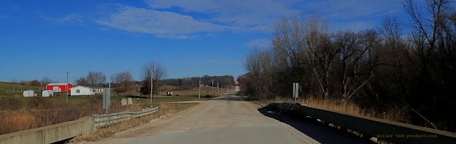
A jog North on Badger and then it was over. I was getting pushed down 265th in Bremer County, the fourth county I'd been in that day, (BH, G, B and B- get it? Tour of Four Counties?), and I was off to go through Janesville and back on much more familiar roads to me.
 |
East Janesville Church as seen from the intersection of Burton and Marquise Road.
|
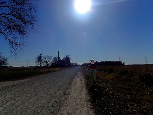 |
The Sun shines through an American flag on this mailbox on Sage Road.
|
I actually beat my goal to get to Janesville by an hour and as I made my way down Garden Avenue to Marquise Road and back East I was looking at finishing well ahead of my self-appointed cut-off time of 2:00pm. The tail wind on Marquise Road was fantastic as the wind picked up in intensity now. It was downright hot going East and I actually welcomed somewhat of a side-wind when I turned South on Sage Road as it cooled me back down a touch.
 |
| A tractor discs up a field just off Sage Road |
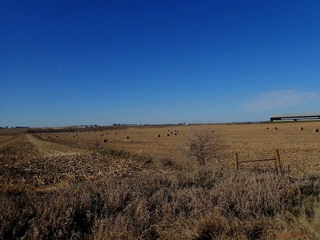 |
Round bales of corn stalks in a field off Sage Road near Co C57.
|
I had no real reason to push hard anymore. I was easily going to come in under my time limitation, so I backed it off and planned to take an extended break at The Big Rock. I hadn't stopped for any real length of time just to rest since I swapped out clothing at about the halfway mark into the ride.
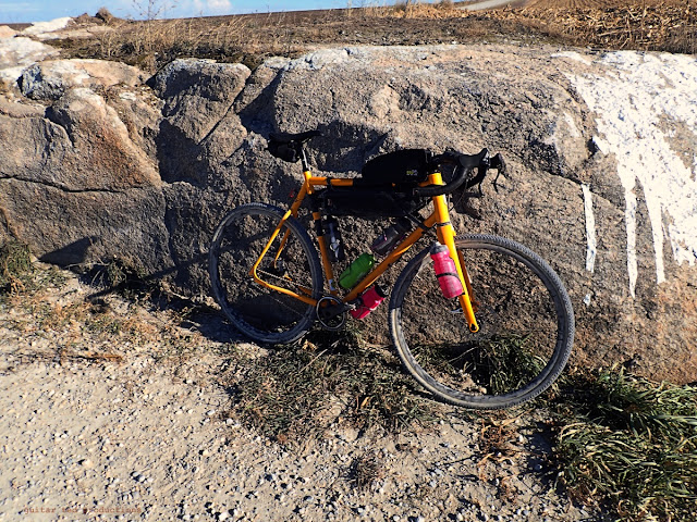 |
Taking it easy at The Big Rock.
|
So I ended up swinging back into Waterloo with just over 65 miles in a total time gone of five hours and fourty-five minutes. I was pretty pleased with that result and I felt good for not having put many longer rides in of late.
I was tickled that I had nailed the route plan and that the winds came up when they did. It all just worked out perfectly. That said, I was ready to be done when I got back to the house. The bike worked great, and everything I used worked well. No complaints.
I saw a lot of interesting things on the ride. Horses were everywhere on this loop. I don't think I rode more than a few miles at a crack without seeing a horse or two. I saw a bunch of pheasants at one point in Grundy County. I scared up a huge buck and four does in Northern Butler County. I saw another mated pair of Red Tailed Hawks. Of course, there were cows, dogs, and other birds. It was a good time.
Is that the last 'big' ride of 2021? Probably. I'd be surprised if I get another chance like I had there Saturday with how the time, weather, and everything came together.

10 comments:
Good work! Sounds like a great ride!
Sounds like a great ride, GT! Even more BA you did it singlespeed. Love seeing photos of that gravel bus.
@FarleyBob - Thanks!
@Tomcat - Thanks! I am not surprised that you approve of the single speed device!
That iron bridge is a beauty! We have lost a few of those around Boone and the surrounding area in the last few years. Wish they would be rebuilt in steel instead of formed concrete. Ever look it up on Bridgehunter.com?
@Gravelo - No, I haven't looked it up there. I should do that.
That site sends me on so many detours and destinations.
@teamdarb - So, you could say you are a kind of 'bridge chaser'? :>)
Those are some long shadows
@blooddoc23 - Truly! This time of year is weird in terms of light and shadow here.
Post a Comment